
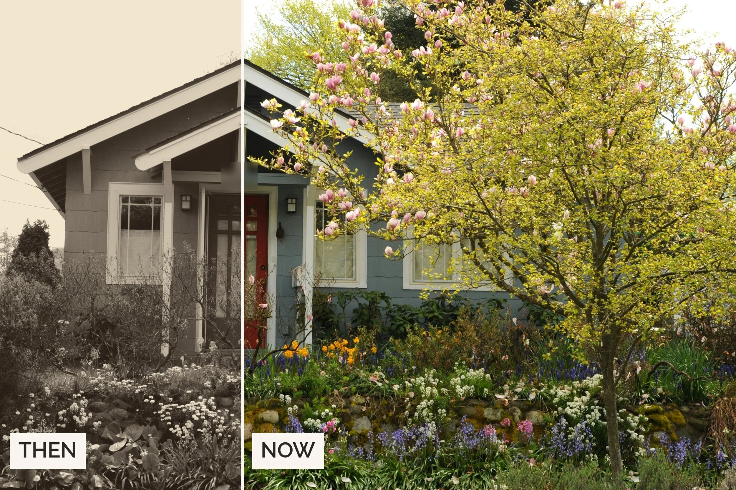
Short answer: the county photographed your house decades ago, and you can get the picture.
Real answer: For most Seattle-area homes, the best historical photo of your house is on the King County Assessor's property record card. A survey that began in 1937 photographed every building in the county, and the cards were kept current through 1972. Search them free on the Washington State Digital Archives, or order a copy from the Puget Sound Regional Archives with your parcel number. Enter your home's year built below to see every record that covers it and how to get each one.
House photo finder
Find the old photos and records for your house
Past clients ask me this more than you'd think. It usually comes a year or two after they move in, once the house starts to feel like theirs. The good news: in King County there's a very good chance a photo of your house exists from long before you owned it. One client ordered hers from the regional archives for about $30. Another got a quick reply from staff and an estimate of about 2 weeks.
How to
Step by step: get your King County record card photo
- Find your parcel number. Look up your address in the Assessor's eReal Property search. It's the 10-digit number, written 123456-7890 for the archives.
- Search the Digital Archives. The King County record card collection searches by parcel number, address or plat name. For an address, leave off N, S, E or W and St or Ave. Only part of the collection is scanned, so no result doesn’t mean no card.
- No luck? Ask the regional archives. Email the Puget Sound Regional Archives in Bellevue ([email protected]) with the parcel number and ask for copies of the photo and the card. Research visits are Wednesday to Friday, by appointment.
- Ask for the folio too. If your home stood between 1972 and 2006, the folio for those years has its own photo. One email can cover both.
- Expect a small bill. Pulling records is free; copies and staff time carry modest fees, and anything around $5 or less is waived. A digital copy from the Digital Archives is $1.
The record card
What a property record card shows, and what it doesn't
The cards were made to value property for taxes, so they're exterior and practical. Here's what to expect.
- Photos
- At least one exterior photo, and another after any major exterior change
- Construction
- Date built, building use, number of rooms and construction details
- Sketch
- A small exterior outline of each building with dimensions
- Values
- Assessed values from about 1937 to 1972
- Paper trail
- Parcel numbers, segregation dates, some owners, excise and permit numbers (all incomplete)
Not on the card: No interior photos, floor plans or blueprints. No architect or builder, no taxpayer names or full list of owners. No map of where buildings sit on the lot.
Seattle
Seattle's other sources: city photos, permits and maps
If the card is the headline, these fill in the story. They also matter for homes built before 1937, which the survey caught already standing but which earlier records only describe. For a walk past some of the city’s best-documented old buildings, try my First Hill walking tour.
| Source | What you get | Years | Cost |
|---|---|---|---|
| Seattle Municipal Archives photos | Houses caught in city work photos | 1800s on | Free online |
| Seattle permit microfilm | Permits and, for newer homes, plans | About 1894 on | Per-page copies |
| Historic Resources Survey | Style, year built, architect | 5,000+ properties | Free online |
| Sanborn maps | Footprint and materials by block | Older neighborhoods | Free with an SPL card |
| City directories | Who lived there, year by year | Address lookup from 1938 | Free |
Beyond Seattle
Outside Seattle: the rest of King County, Snohomish and Pierce
The rest of King County
Everywhere in King County gets the same record cards and folios. Outside Seattle city limits, the 1936 aerial survey adds an overhead view from before the war, and permits sit with your city or the county.
Snohomish and Pierce counties
In Snohomish County, the Assessor has put its 1970 to 1999 field books online, some with pictures. Sno-Isle Libraries keeps a good getting-started guide. In Pierce County, start with the Tacoma Public Library's Buildings Index, which links photos from its Northwest Room collection.
Recent years
Photos from the last 20 years: Street View and old listings
Google Street View
For recent history, Google Street View keeps older images for many streets. On a computer, drag Pegman onto the map and click See more dates.
Old listing photos
If your home sold in the last couple of decades, its listing photos are probably still on Zillow and Redfin. Save the ones you like, because they show the house as it was before your changes.
If you’d rather they disappear, you can claim the home as the owner. Zillow lets you delete the photos and Redfin hides them. Realtor.com may make you wait about 6 months after a sale (steps here).
For owners
Put the old photo to work
- Restore what was there. Original siding, window patterns, porch posts and trim show up clearly, which is exactly what a contractor or architect needs before a restoration.
- Check what changed. Compare the photo, the card's sketch and today's house to see which additions came later, then match them to permits.
- Start a house file. Keep the card, folio, permits and plans together in one folder. You'll want them for every remodel, and the next owner will too.
- Frame it. A 1937 photo of the house, hung by the front door, is the best housewarming gift I know of.
FAQ
Frequently asked questions about historical photos of your house
How do I find historical photos of my house for free?
In King County, search the Washington State Digital Archives record card collection by parcel number or address. Then check the Assessor's current photos and Google Street View history. All 3 are free. A copy from the Digital Archives is $1.
What is a King County property record card?
A card the Assessor kept for every parcel from 1937 to 1972, started by a Works Progress Administration survey. It has at least one exterior photo of each building plus construction details and assessed values. The originals are at the Puget Sound Regional Archives in Bellevue.
My house was built before 1937. Is there a photo of it?
Very likely. The 1937 survey photographed every building standing in King County, whatever its age. For earlier views, try the Seattle Municipal Archives photos and Sanborn maps. The 1866 to 1937 tax rolls list owners and values but have no photos.
How do I find out exactly when my house was built?
The Assessor lists a year built, and the record card notes the date of construction. In Seattle, permit records go back to the 1890s, and the Historic Resources Survey has dates for more than 5,000 properties.
Can I see old pictures of my house on Google Maps?
Often, yes. On a computer, drag Pegman onto the street and click See more dates to scroll back through older Street View images. Google notes that history isn't available everywhere (Google's steps).
How do I get old listing photos of my house off Zillow?
Claim the home as the owner, then delete the photos in Zillow's edit screen. On Redfin you can hide them from the owner dashboard, and Realtor.com may make you wait about 6 months after a sale.
Can I get the original blueprints for my Seattle house?
Usually not for older homes. Record cards have only an exterior sketch, and the city's single-family plans on fiche start around 1974. For newer work, approved plans can be emailed if you send the permit number and address to [email protected].
Do I need my parcel number?
Yes. The regional archives can't search by street address alone. Find the 10-digit number in the Assessor's eReal Property search and write it with a hyphen after the sixth digit, like 123456-7890.
How long does the regional archives take?
If the card is scanned, the Digital Archives has it instantly. For requests, my clients have had quick replies from staff and an estimate of about 2 weeks.
The bottom line
If your house is in King County and was standing by 1972, a county photographer almost certainly took its picture. Find your parcel number and search the Digital Archives. If it isn't scanned yet, one email to the regional archives in Bellevue gets it for you.
Sources
- Real property record cards, King County Archives
- Historical photos, King County Archives
- King County Assessor, Real Property Record Cards, 1937-1972, Washington State Digital Archives
- Puget Sound Regional Branch, Washington State Archives
- Reproduction services and cost recovery, Washington State Archives
- Resources for property history research, Seattle Municipal Archives
- Research a project, permit, or property, Seattle Department of Construction and Inspections
- Historic Resources Survey, Seattle Department of Neighborhoods
- Assessor historical records, Snohomish County Assessor
- Getting started with property research, Sno-Isle Libraries
- Old house research guide, Snohomish Historical Society
- Check out the Tacoma-Pierce County Buildings Index, Tacoma Public Library
- Use Street View in Google Maps, Google Maps Help
- How to remove house photos from real estate sites, Security.org