
Beacon Hill
Moving to Seattle? What is Beacon Hill like?
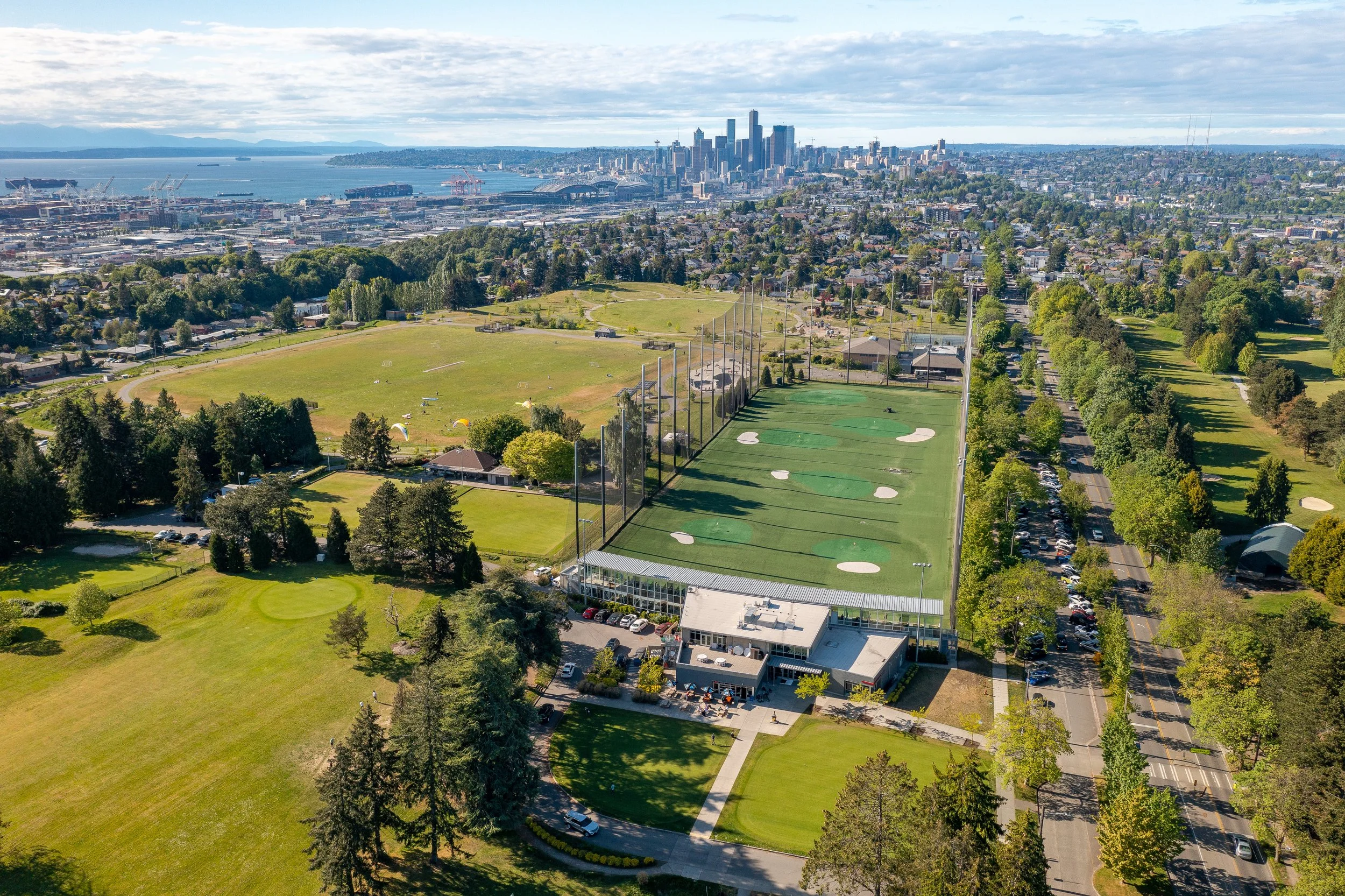
Beacon Hill speaks directly to home buyers who want both refuge in nature and real connectivity. Perched about 5 miles south of downtown Seattle the neighborhood sits on a bluff that delivers sweeping views of Elliott Bay and the Olympic Mountains to the west and Mount Rainier and the Cascades to the east on clear days. Public green sanctuaries abound: Jefferson Park is the crown jewel with its Olmsted‑inspired trails, golf course, playgrounds, and great vistas while smaller gems like Jose Rizal Park, Maple Wood Playfield, Dearborn Park, and the Beacon Food Forest lend woodland quiet and community gathering space.
On the private side Beacon Hill blends architectural charm and modern convenience: homes range from early 20th‑century Craftsman and Seattle Box styles to contemporary townhomes built in the 2010s that offer refined finishes and thoughtful layouts. Amenities include walkable, locally owned restaurants and markets, a Link Light Rail station for fast transit, and a strong sense of diversity and culture. Beacon Hill pairs comfort with access to nature and city life.
Where is Beacon Hill?
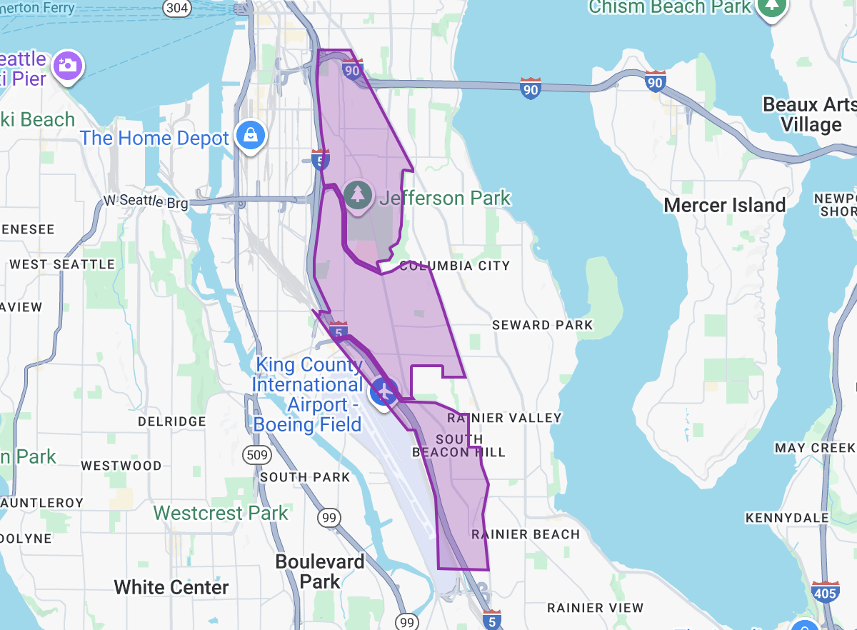
Beacon Hill is generally divided into 3 neighborhoods- North Beacon Hill, Mid Beacon Hill, and South Beacon Hill. The overall Beacon Hill area is
North of Tukwila’s Allentown neighborhood
East of the Duwamish Waterway and West Seattle’s
South Park, Riverview and North Delridge neighborhoods
South of International District
Southwest of Central District
West of Mount Baker, Columbia City, Brighton, Dunlap, Holly Park and Rainier Beach
Downtown Seattle: 10 min (3.1 mi)
SLU: 11 min (4.4 mi)
I-5 Access: 4 min (I-5 flanks the Western edge of Beacon Hill)
520 Access: 11 min (5.2 mi)
I-90 Access: 5 min (I-90 runs through the northern edge of Beacon Hill)
Downtown Bellevue: 16 min (10.5 mi)
Beacon Hill has its own Light Rail Station, making commute to other parts of Seattle even easier than ever.

What’s around the Beacon neighborhoods?
EXPLORE
-
If you’re checking out Beacon Hill in Seattle to see if it might be home, here are a few standout things to explore beyond the usual shopping and food:
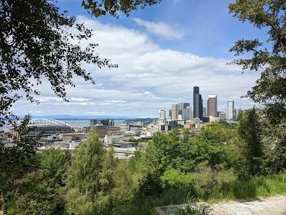
Jefferson Park: Beacon Hill’s big green anchor. You’ll find great views of the city and Olympics from high up, a golf course, play fields, a skatepark, and creative playground gear like zip lines and slides.
Beacon Food Forest: A 7‑acre community garden/ food forest where you can wander through edible beds, see how a permaculture design works, and even pick some fruit. It’s both peaceful and communal.
Dr. José Rizal Park. A quieter hilltop park with picnic shelters, wooded slopes, and sweeping views toward downtown and Elliott Bay. Great for sunsets or a calm weekend walk.
Daejeon Park. Up near the northern edge of Beacon Hill, it includes a Korean‑style pagoda and pleasant vistas (including of Mount Rainier), melding cultural design into the greenspace.
Beacon Hill Branch Library + Public Art. The local library has more than books: check out the “Dream Ship” kinetic sculpture on top, and outside there are haikus, neighborhood writing, and art integrated with the landscape.

DINE
-
In recent years, Beacon Hill’s food scene has seen a lot of new and interesting options, in addition to the historically wonderful array of international foods. Here are a few exciting restaurants you should try if you're exploring Beacon Hill. They really give a feel for what the neighborhood is like:
If you want elevated comfort food in a warm, welcoming setting, Musang is a must. Its Filipino classics like pork & shrimp lumpia, short rib kare‑kare, and tender brisket are deeply satisfying, and chef Melissa Miranda does a great job balancing familiarity and fine‑dining flair.
For something more casual but local‑tuned, Familyfriend is pretty unique, Guamanian bistro vibes, menu mash‑ups with Spanish, Mexican, Korean, and Southeast Asian influences, plus standouts like corn soup and seafood kelaguen.
Craving Italian? Bar del Corso offers rustic, seasonal Italian food. Neat wood‑fired pizzas, antipasti, and well‑curated small plates in a cozy space.
If you want something more low-key or “local legend” style, stop by Beacon Hill Shell Station for fried catfish. It’s about as dive‑y as it gets, but people really love it.
Also, be sure to check out The Coupe & Flute, a swanky champagne bar that is the perfect way to start your evening.

SHOP
-
Beacon Hill is dotted with small, locally loved shops: Urban Feed & Garden offers pet, plant, and home‑goods charm; Day Moon Press sells letterpress and artful paper goods; and ethnic groceries like La Esperanza Mercado y Carnicería and Fou Lee Market bring Latin American and Asian imports to your doorstep. For more everyday food shopping, you’ll find HC Grocery (Asian‑centric) and 2801 Marketplace/Graham Street Grocery anchoring the neighborhood. A local favorite: the seasonal Beacon Hill Farmers’ Market and pop‑up Filipino sidewalk markets feature produce and prepared foods many insiders rely on.
Is Beacon Hill safe?
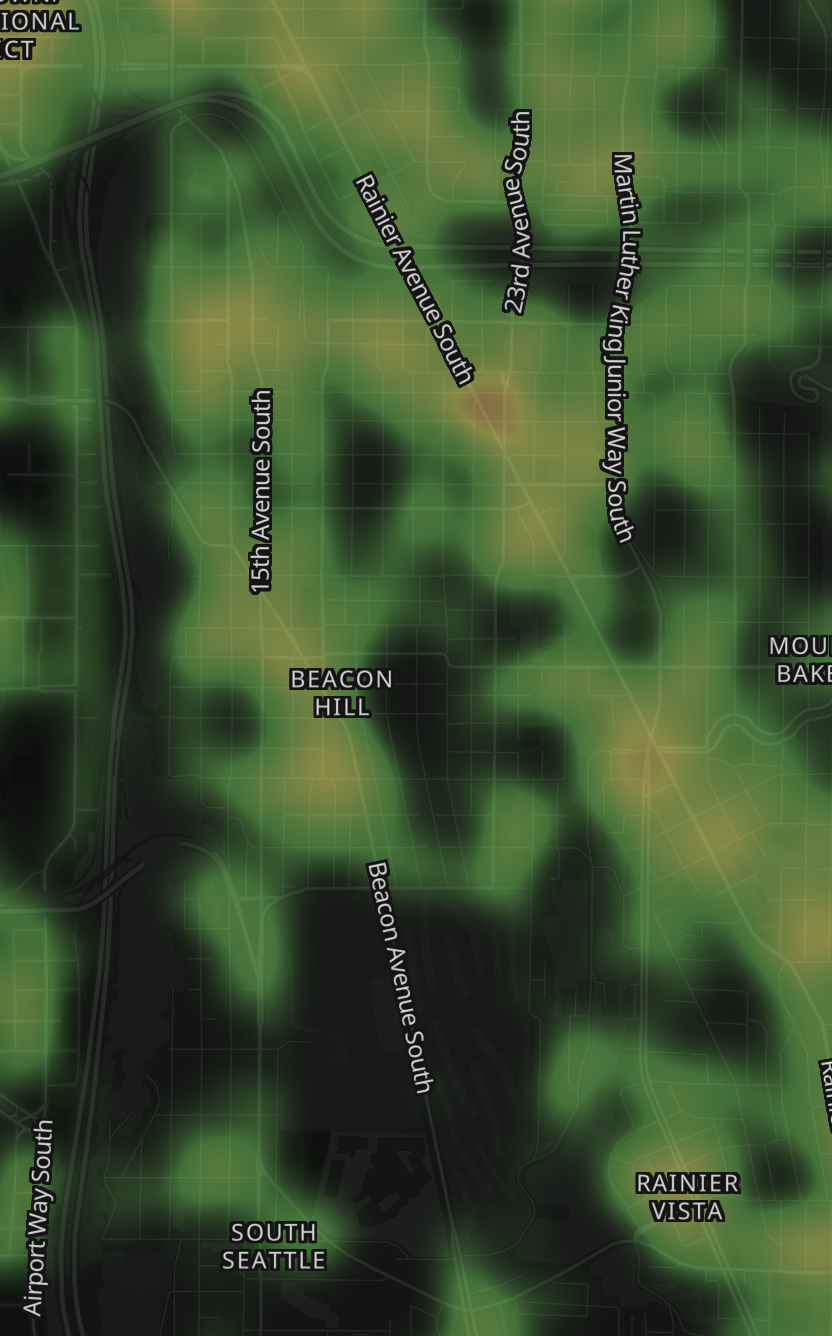
Crime levels vary block by block and change over time, so Brian encourages buyers to review current reports from the Seattle Police Department before choosing a home.
North Beacon Hill

Mid Beacon Hill
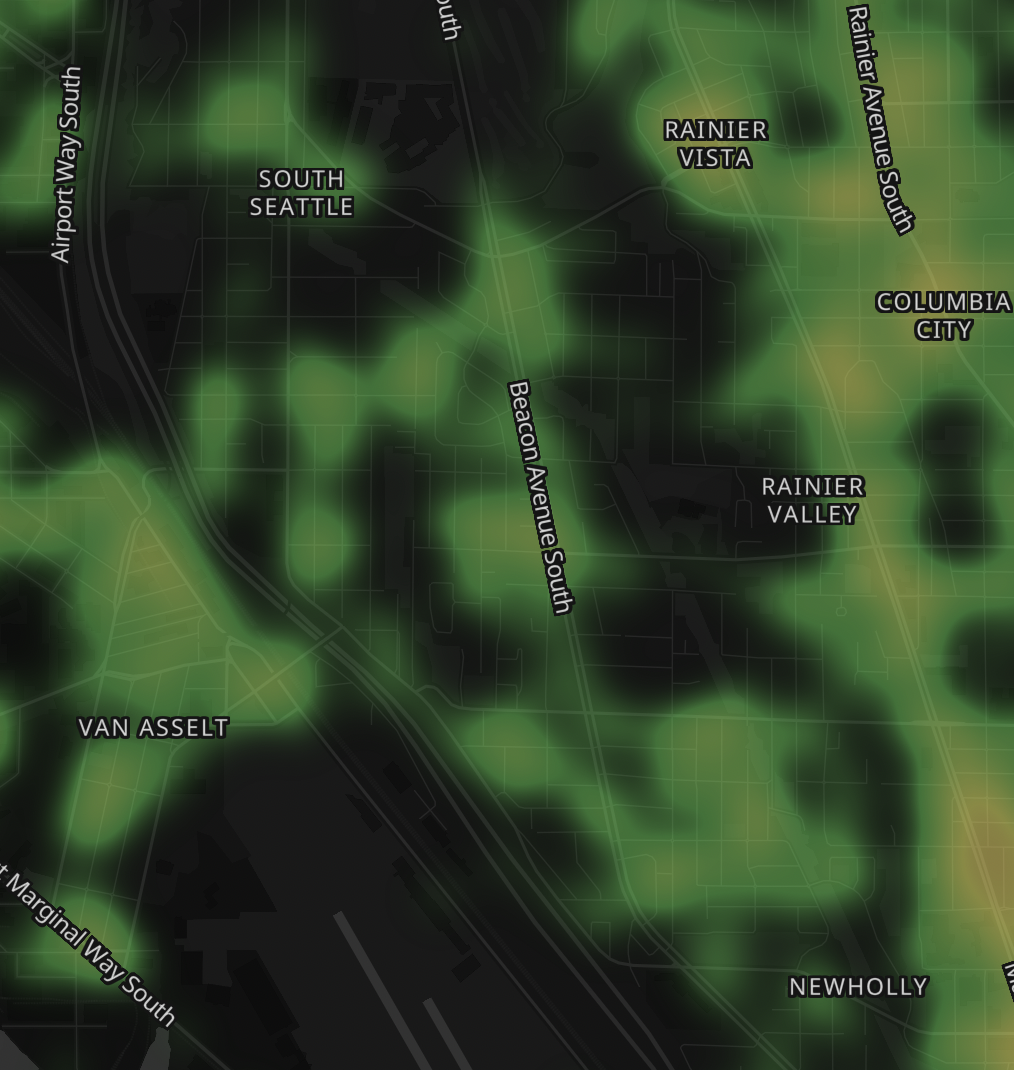
South Beacon Hill
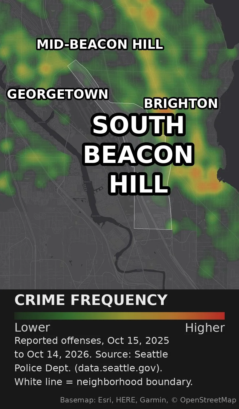
Facts and resources for Beacon Hill
Name & Geography Origin
The neighborhood was named in 1889 by M. Harwood Young, a Union Army veteran, after Boston’s historic Beacon Hill. Beacon Hill is a ridge or mesa, rising to ~350 feet above sea level. Its west boundary was once tidal flats of the Duwamish, filled in as industrial expansion pushed Seattle’s shoreline outward.Civic Organizations
Beacon Hill School is the site of El Centro de la Raza, a major community and civil rights organization. In 1972, organizers from immigrant & Latino communities occupied a disused school building and, after activism, secured a lease. The building now serves many functions: social, educational, cultural. Beacon Hill also has its own community council.Beacon Food Forest
Adjacent to Jefferson Park is a ~7‑acre food forest, an urban agriculture project that combines edible plantings (nut/fruit trees, berry shrubs) with gathering space. It’s believed to be the largest public‑land food forest in the U.S.The Median Trail
Between the lanes of Beacon Avenue South is a wide median that once accommodated a water pipeline, then a streetcar line, later turned into a muddy/gravel strip, and finally transformed into a walking and biking trail flanked by trees. It's now beloved by locals as a 4‑mile-ish respite through the middle of the hill.Pacific Tower
On the northern edge of Beacon Hill is the Pacific Tower, an art deco building, originally built as a hospital, later it was used as headquarters for Amazon for about 10 years. It overlooks downtown and has landmark/historic status.
Beacon Hill Demographics and Statistics
Population Growth (since 2000): 13%
Population Density (ppl / mile): 5,729.20
Household Size (ppl): 3
Median Age: 38.29
Annual Residential Turnover: 27%
5+ Years in Residency: 28%
Median Year in Residency: 2.55
Households w/ Children: 29%
Population by Age Group
Household Income by Dollar Range
Highest Education Level Attended
Beacon Hill Homes For Sale
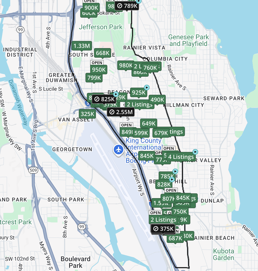
Homes currently for Sale in Beacon Hill
Q&A with your Beacon Hill realtor
-
Moving into a condo in Beacon Hill is an excellent idea. Condos are also typically maintenance-free. There are many “boutique” condos where you would/should have a role in maintaining the community. The beauty of these smaller condos is that it’s almost like co-op living - for the most part it’s still maintenance-free where the building is taken care of by whoever your community hires to take care of it, but you decide as a community what you want in the gardens and such. Much less work than owning a house.
-
There are many townhomes built in Beacon Hill compared to places with larger lots. Many newer rowhomes and the like have popped up over recent years. Townhouses here offer low-maintenance living with more room than a condo.
-
Beacon Hill is a great place for single-family residences as that’s what most buyers expect here. Many are in very walkable locations.